
mdrejhon 8


I'm not familiar with Tracking Derbies. Sounds more like a speed contest than a distance contest. The Lodi tracking competition, as I understand it, is best distance from a given altitude, without time consideration. That would mean the flattest track would win, regardless of speed.Quote
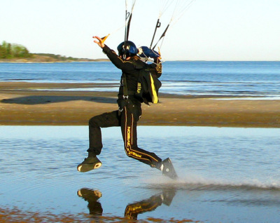
Tracking Derby requires a steeper position because it is judged by how far you can go in a certain amount of time, rather than a certain amount of height.
True, but it's the most accurate known means of measurement and GPS is recommended by www.trackingderby.com -- they have custom software recommendations to analyze this GPS data. It wouldn't be perfect, but would probably be the most accurate method known to skydivers at this time.QuoteIts not really that easy, since you would need to know the exact winds at different altitudes in order to come up with any conclusions of a efficient track in terms of altitude loss for example..
Get one of these, turn it on in the plane and make sure it's near a window, then just before jumping, slip it in your audible pocket (best results if it's not a covered audible pocket, and you can slip in the audible without taking off the helmet) and do your thing.
When you land, plug (can do either USB or Bluetooth) the tiny Wintec WBT-201 into your laptop computer and view your altitude/distance graph (including both horizontal and vertical speed), or superimpose your tracking tracjectory on Google Earth, etc. A GPS logger essentially logs your XYZ coordinates once a second in all three dimensions and works wonderfully with many wingsuit jumpers. Currently, it is a favourite GPS because of the quality of wingsuit trajectory logging (i.e. proven useful for skydiving -- search the wingsuit forum)
If you get a Garmin branded wrist mounted GPS, get the 301 or later instead of 201 because it is MUCH better: Locks onto a GPS signal much more quickly. In addition, just make sure you get a GPS lock while on the ground before entering the airplane, the warm-start "Reacquire" time is always faster (just wait at jump door for 2 seconds - easily done during an exit count) than the cold-start time (need 30 seconds to initalize)
Of course, GPS is something of more serious interest to serious tracking derby people and wingsuit jumpers, and is overkill if you only have a passing curiousity about your horizontal speed.
[EDIT: Checked, if a wrist mount is used, the best wrist mounted Garmin GPS would be the 205 and 305 because of better GPS 'sensitivity' -- I doublechecked.]
Share this post
Link to post
Share on other sites