Recommended Posts
Uh… uh… Hello…ello…llo..o
HELLO… ELLO… LO…o
Anybody out there?… here…. ere… e
Mummm… I guess nobody’s there.
Web Page
Blog
NORJAK Forum
HELLO… ELLO… LO…o
Anybody out there?… here…. ere… e
Mummm… I guess nobody’s there.
Web Page
Blog
NORJAK Forum
winsor 236
People who do not spend much time outdoors tend to discount how bad the elements can be. These people include both posters here and those who would jump blindly into the elements while wearing traveling clothes.
This guy:
clicky
was in better shape than Cooper - at least as far as knowing where he was and proximity to help was concerned - but it did not do him much good.
If Cooper survived, it was not due to careful planning or a clear picture of what he faced.
Blue skies,
Winsor
This guy:
clicky
was in better shape than Cooper - at least as far as knowing where he was and proximity to help was concerned - but it did not do him much good.
If Cooper survived, it was not due to careful planning or a clear picture of what he faced.
Blue skies,
Winsor
377 22
Somewhere there are tables published on survival time before hypothermia disables you. If Cooper was wet (very likely) then heat transfer out of his body would go faster. I don't know of any experienced skydivers who would make Cooper's jump in the clothes we think Cooper wore. The apparent lack of planning (garb and shoes) is hard to reconcile with any assumptions about Cooper being an expereinced jumper, military or civilian. Either that or he planned to exit right after takeoff, be picked up in minutes and then clothes wouldn't matter so much.
2018 marks half a century as a skydiver. Trained by the late Perry Stevens D-51 in 1968.
Based on a PM I got, I started thinking; “exactly what was the terrain like along the flight path? And, how can it be best represented?”
So, I have produced a profile of the track that I think Flight 305 took that night. It is the centerline of Victor 23. It’s designed to be interactive, so it doesn’t translate to a still image very well. The vertical scale is 0 to 2500 feet. So the peaks are way out of proportion to the ground track.
It begins at SEA-TAC on the left and ends at the RAWER Fix just south of Portland. The red crosshatched areas are maps that are off the disk (I haven’t figured out how to merge two disks yet), but that is south of the area of interest for most folks. Goble Mountain and Schumaker Mountain are flagged. The high peak at about 50 miles out is an unnamed peak about 4 miles south of the Thurston County - Lewis County line. It is 5.3 miles SE (143 deg True) from the center of the Skookumchuck Reservoir.
The important thing to notice is that the first 40 miles is pretty mild terrain, the next 75 is pretty severe, and the last 25 or 30 are very flat and mostly free of trees.
He may well have wanted to jump very near the airport (SEA), but I don’t think that was much of a plan if he did. The 1st 20 miles (SEA to Parkland) the plane would spend some of that climbing to 10,000 feet. The rest would put him over McChord AFB. The next 11.2 miles is from Parkland to the end of property that is part of Fort Lewis. Then the next 12.3 miles is from the edge of Ft. Lewis to around the Lawrence Lake/Reichel Lake area. So the 1st 21.2 miles offers urban areas and military bases as possible DZs. I don’t think he would have gotten away with that (if that was his plan). The last 12.3 miles of that first 33.5 would be mostly rural farmland. This might have been his original plan.
The next 81 miles is really inhospitable. This is the kind of terrain that most people think he jumped over. Then there’s that 23 miles (or so) that I think he jumped over. It is level (mostly) and in 1971 almost all farmland. The BTG VOR is 120 miles out on this track (it is shown right above the digits “120” as a tiny blue bubble on the profile. That’s where I think he jumped. Not by choice, but by chance.
BTW: That jump would have occurred at 2013 PST (using the FBI’s timeline).
Web Page
Blog
NORJAK Forum
1969912 0
You're right about the terrain. Most of that area is quite flat. The link below is to a Wikimapia map centered on the BTG VOR (zoom in and you can see the VOR calibration/test antennas around the building). Ariel, WA is due North. Victor 23 runs into BTG from 329 degrees North, which is ~parallel to I-5 between La Center and the I-205 junction. Click "view" at upper left to change view to terrain/satellite, etc.
Second link is to photos of the Fargher Lake area, which is just right of center at the top of the Wikimapia map. The terrain at Fargher Lake is very typical for that area.
http://wikimapia.org/#lat=45.747819&lon=-122.591522&z=11&l=0&m=h&v=2
http://www.lewisriver.com/fargherlake/gallery/2005-misc.html
FWIW
"Once we got to the point where twenty/something's needed a place on the corner that changed the oil in their cars we were doomed . . ."
-NickDG
QuoteYou're right about the terrain. Most of that area is quite flat

I just did it and I deleted it -
I felt it was not safe to leave this post up - so I deleted it - GOD why am I sick I need to go to WA. now - I just hope the area I pinpointed with in a 10 mile area is not developed - afraid to say too much on line because a man called me today who is ruthless and he keeps trying to get me to tell him how to find Tina - he lies to me in every breath -- he bugged me in 2003 and suddenly calls out of the blue again - said this was the number he called - got news I didn't use this number until 6 months ago when I let you guy have it - so he is postng here. On the phone he told me he was an attorney - - I don't believe that for one moment. Before when I checked him out he was using a calling card and the address he gave me was not correct. I did find out his home number thru an investigator and left him a message at his home...never heard from him again until today.
He acted like he was unaware of Mayfield - that is baloney - how can you live in that area and not be aware of Mayfield? I believe I know now which poster he is...and I told him lots in a pm - need to learn when to shut my mouth - right. Obviously this man will stoop to anything including badgering a girl who doesn't want to talk to the media - perhaps he needs to watch the new clip from 1971 when Tina got off that plane - let me assure you she was traumatized. The last thing she need is someone like him in her face.
1969912 0
QuoteQuoteYou're right about the terrain. Most of that area is quite flat
I just did it and I deleted it -
If you are asking how to keep the map, just add it to your "bookmarks" (might be called "favorite places" or something in Windows Internet Explorer). To open that map again just click on it in your bookmarks or favorites list. The map will open to the same zoom, etc. as when you saved it. Not sure if that helps.
If you can give me a general idea of where to look, I can search the satellite images for the pipes and/or wires. There are several places where big powerlines cross.
This may help you get your bearings when looking at the map: At one time you mentioned thein Vancouver Red Lion Inn, which is right beside I-5. It's offficially called "Red Lion Hotel Vancouver at the Quay". The link below is to a map centered right on the hotel, and you can see I-5 on the right. Downtown Vancouver is pretty much due North. Just zoom out as needed and follow the river. When you want to save the map, just add the current view (webpage) to your bookmarks/favorites. The zoom and location will be saved. If you look at the actual URL in the little box at the top of your web browser (example: http://wikimapia.org/#lat=45.622052&lon=-122.675094&z....), you can see that the lat/long coordinates, zoom, etc. are in the URL. As you scroll/zoom around those numbers will change, and when you bookmark/favorite a map view, the URL is what gets saved.
Red Lion: http://wikimapia.org/#lat=45.622052&lon=-122.675094&z=18&l=0&m=h&v=2
Not sure if this is of any help, but hope so....
"Once we got to the point where twenty/something's needed a place on the corner that changed the oil in their cars we were doomed . . ."
-NickDG
I don't need anything on the Columbia - but I know I need to go to WA. or find authorities and people who can be trusted to let me direct them to the place -with cameras relaying back to me I will know when we find the place...somehow this should be able to be set up...I cannot fly right now except at very low altitudes and I have very serious tests scheduled that have to be done. None of this will prove that Duane is Cooper unless we find some evidence of whatever he buried there.
I found some old black and white copied totography maps I had, but no details of roads or terrain. I estimate he had about 2 miles to walk from one landmark and much further to reach the other points all with a landmarks. Unbelievable he was able to do this and the FBI not spot him - if I pinpoint it on a map then someone with the forestry dept records should be able to tell us what was there in 1979 and 1971. Also - when was the tower taken out as it wasn't there in 1979. This is going to answer a LOT of question.
I can't explain the FBI's DNA and fingerprint expertise - but my Gut told me that no man would fabricate this on his deathbed and have told another person many things over a period of yrs that in themselves meant nothing at all but that the sum total of these is the story of Dan Cooper. My desperate prayers where heard on this 11th day of Feb 2008. I have come from the lowest point in my life early this evening to the realization that nothing is impossible with God. When I went so low today was after a phone call from the man who has badgered me in the past - and my therapy after my talk with God was to write to Tina - a letter that I would never mail...and then this map shows up tonight - God does answer prayers.
I realize that we may find nothing - but I will know I stayed the course and did my best.
Albert18 0
Boy, that area around Fargher Lake looks like some vicious country doesn't it.
When you look at all the farmland along the flightpath in this area, you start to understand why the FBI needed such strong winds blowing him to the east/northeast and for him to open his chute the instant he jumped.
Quote, How do you get from a wilderness jump (or farmland jump) and blend back in when there is so much news circulating? Every guy who looked wet and disheveled was a suspect that night.
There was a cabin on the Columbia - owned by an individual who didn't live there.
Copyright 2006, 2007, 2008, 2009, 2010, 2011, 2012 2013, 2014, 2015 by Jo Weber
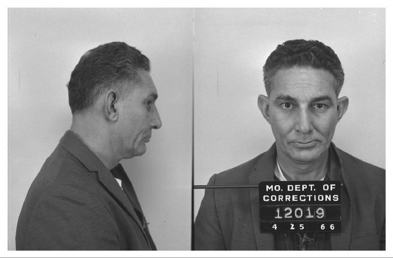
Only if the loafers fit . . . too bad they were never recovered or we could do a Cinderella on you to find out.
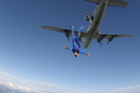
The World's Most Boring Skydiver
Share this post
Link to post
Share on other sites